Map - Boating
- Map
- Map - Boating
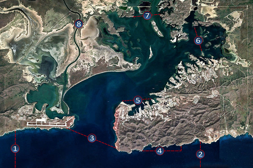
Legend
Tackle Box - Western Edge
Map
Notes
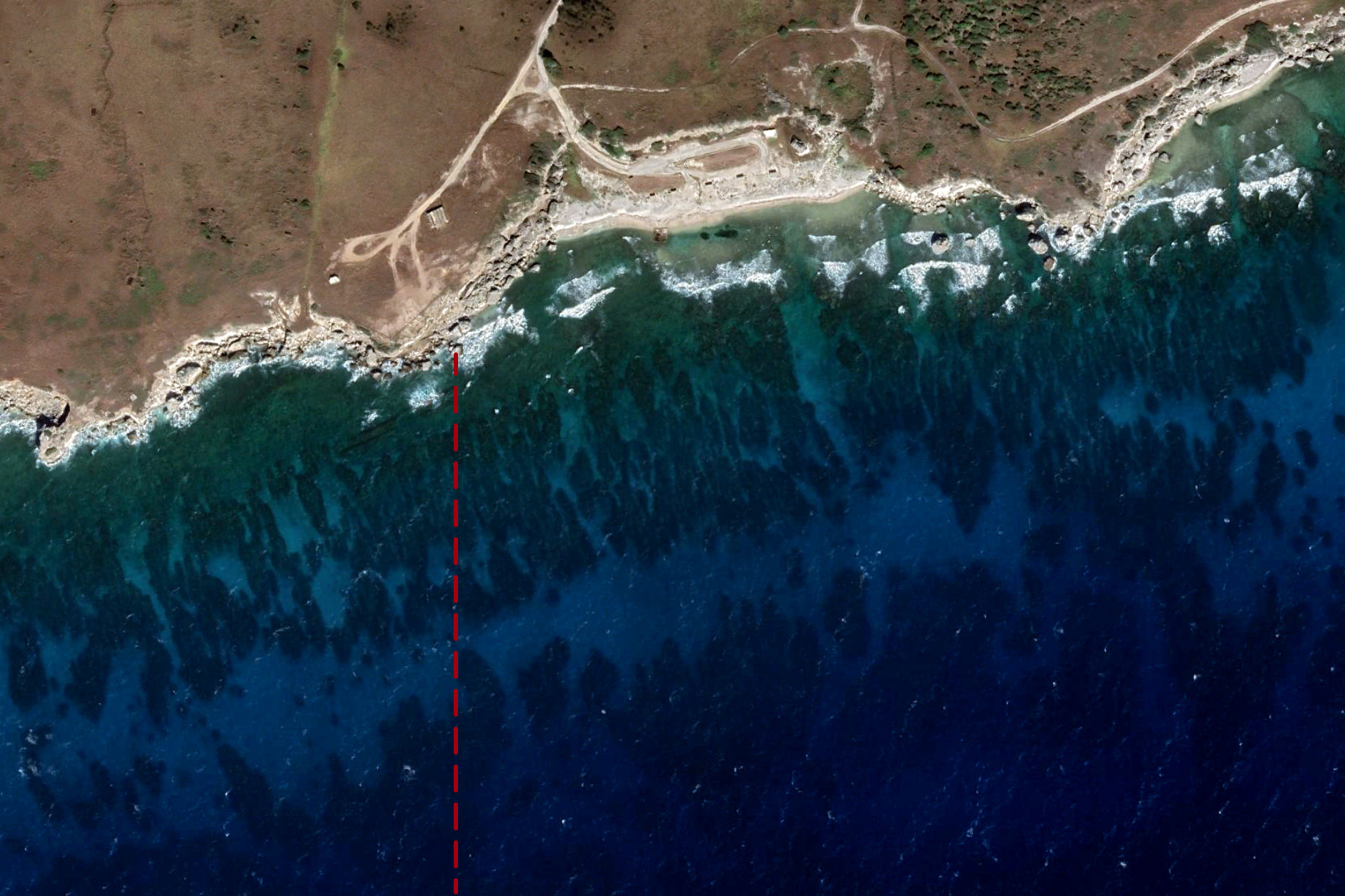
The western edge of the Tackle Box is just beyond the west side of Chapman Beach.
Look for a small structure on a hill overlooking the beach.
Use caution when anchoring, diving, and navigating in the area. Cuban waters are just 700 yards to west (less than 1/2 mile). Strong prevailing winds and currents usually flow to the west.
Coordinates
Northern Point: 19.903310 | -75.225663
Southern Point: 19.722617 | -75.225663
The southern edge is 10 nautical miles south of Guantanamo Bay.
Tackle Box - Eastern Edge
Map
Notes
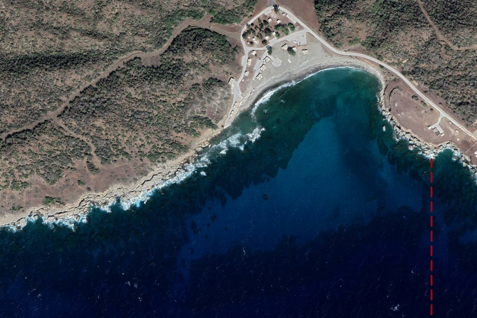
The eastern edge of the Tackle Box is just beyond the eastern side of Windmill Beach.
There is a restricted area 100 yards prior to the edge of the Tackle Box. Swimmers and vessels are prohibted from entering the area noted by a small white buoy.
Coordinates
Northern Point: 19.897261 | -75.115035
Southern Point: 19.722617 | -75.115035
The southern edge is 10 nautical miles south of Guantanamo Bay.
Southern Boundary
Map
Notes
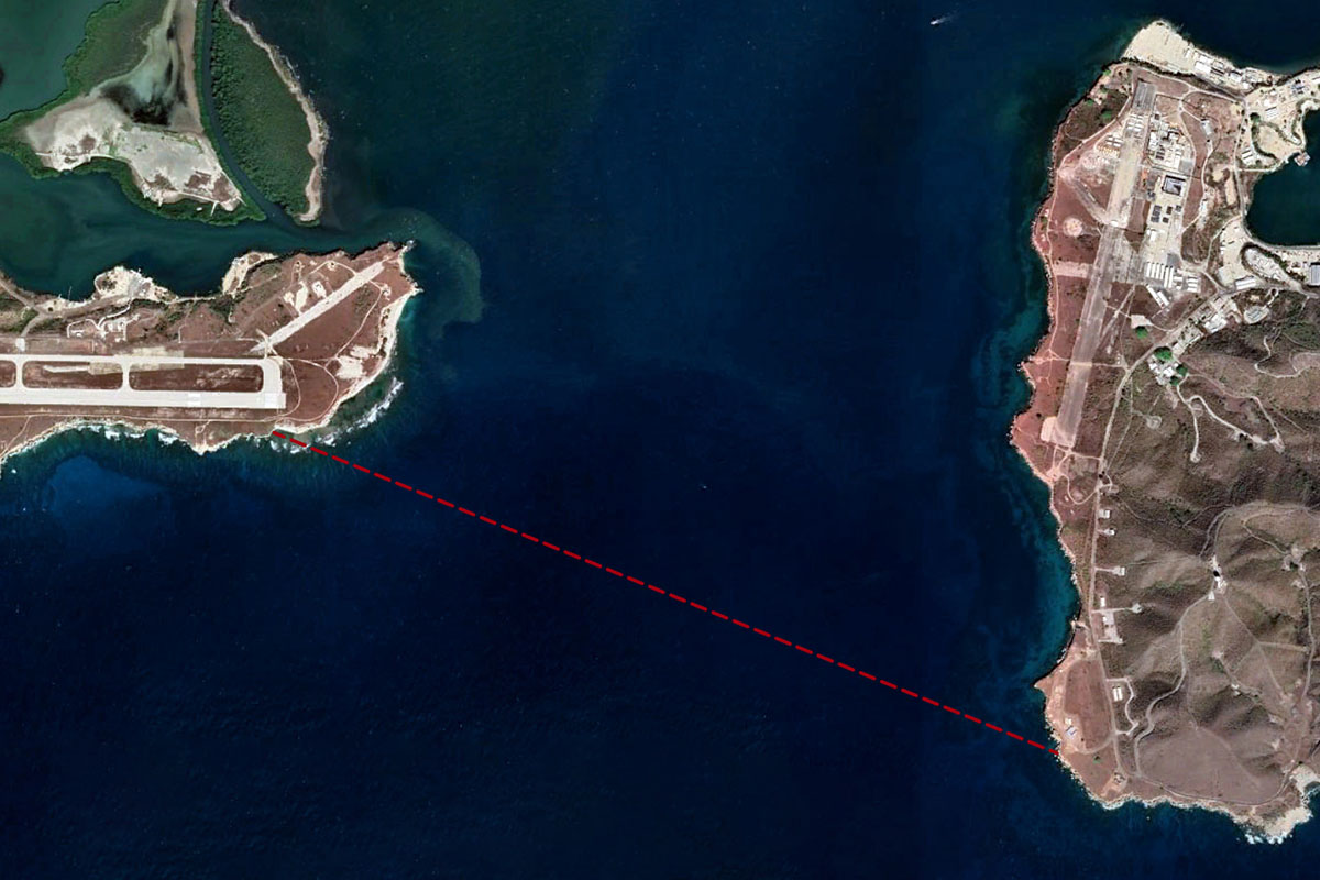
The Southern Boundary is a line crossing the entrance to Guantanamo Bay.
The line extends from Leeward Point to the Lighthouse. While offshore, you can get an approximate line by connecting the airfield tower on the Leeward Side to the Lighthouse on Windward.
Rental boats are not permitted beyond the Southern Boundary. Privately owned boats require a Tackle Box rating and the captain must have the additional Tackle Box endorsement.
Vessels entering and exiting the Tackle Box must request authorizaton from Port Control and travel in tandem with another vessel rated for the Tackle Box.
Coordinates
Leeward Side: 19.905227 | -75.195661
Windward Side: 19.893487 | -75.165592
Marine Replenishment Zone
Map
Notes
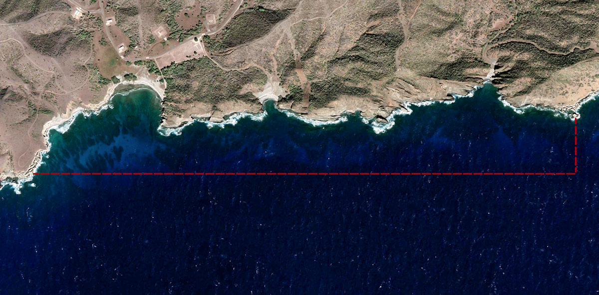
The Marine Replenishment Zone is an area protecting the southern waters on the Windward Side of NSGB.
The zone includes Cuzco Beach, Blue Beach, and Blind Beach.
The zone extends approximately 300 yards from the shore.
Fishing in the zone is prohibited.
Coordinates
Western Point: 19.892400 | -75.150300
Southeastern Point: 19.892400 | -75.126600
Northeastern Point: 19.894700 | -75.126600
Industrial Zone
Map
Notes
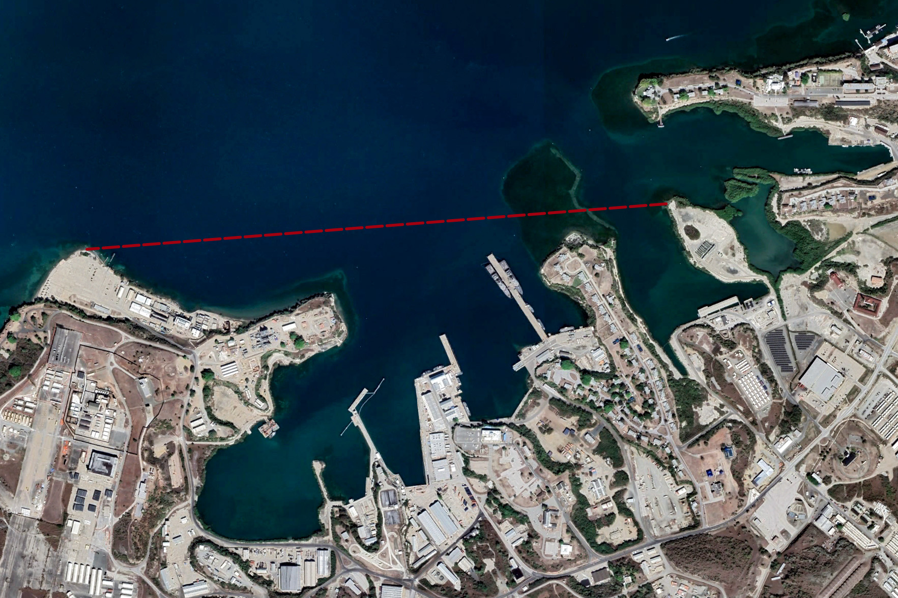
All private and rented vessels are prohibited from entering the Industrial Zone.
The line extends from Ferry Landing to the Fleet Landing Channel.
Coordinates
Western Point: 19.919970 | -75.161760
Eastern Point: 19.921254 | -75.144580
Range Exclusion Zone
Map
Notes
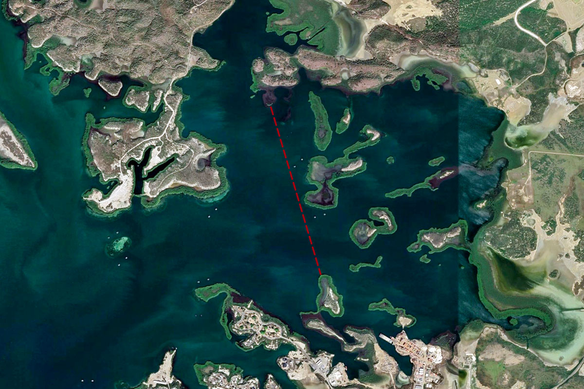
The Range Exclusion Zone is an area on the eastern side of Guantanamo Bay.
Coordinates
Northern Point: 19.961352 | -75.118635
Southern Point: 19.948508 | -75.114435
North Gate
Map
Notes
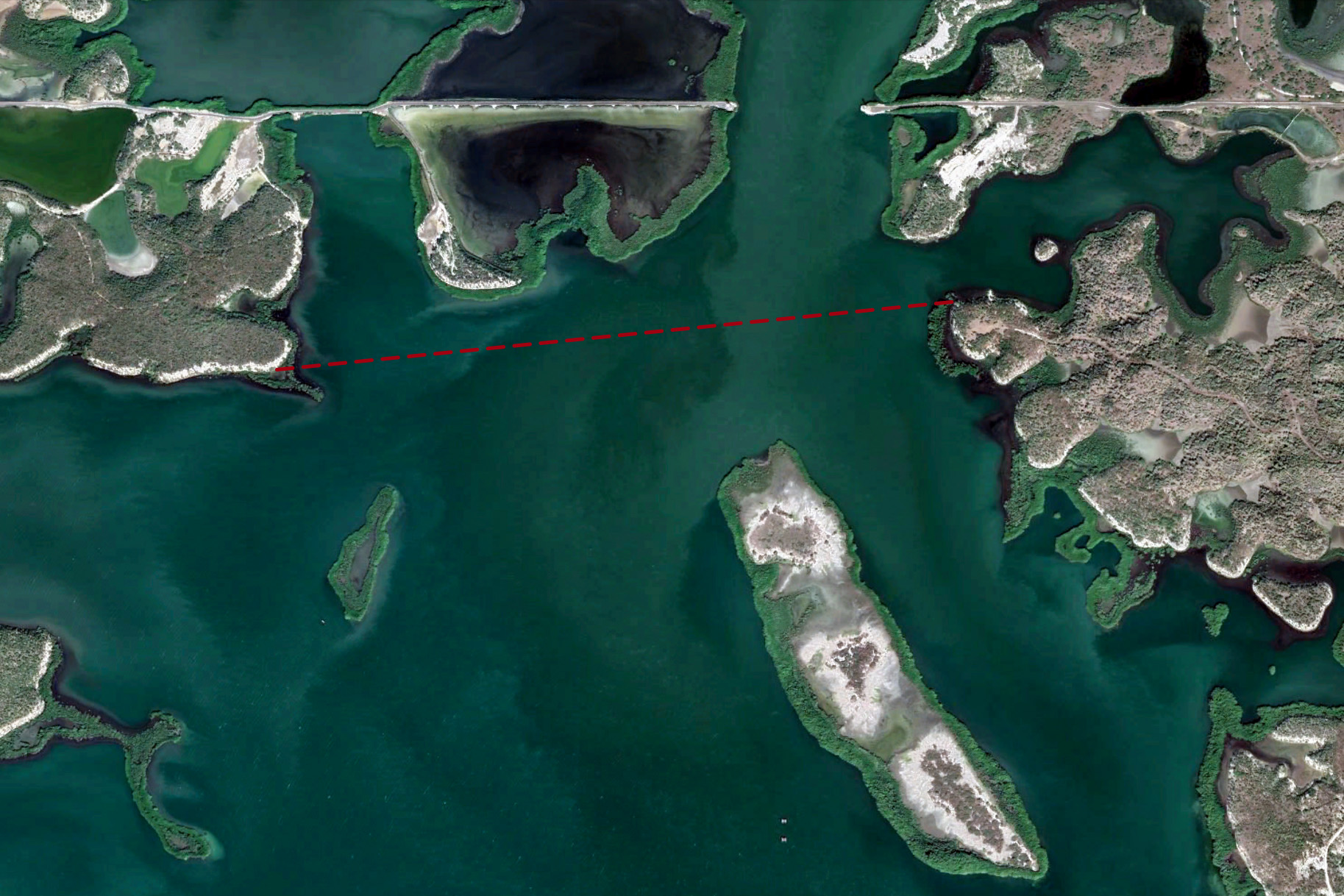
The North Gate is the entrance into the northern part of Guantanamo Bay. Beyond the gate is Cuban territory.
Crossing the North Gate is prohibited.
Unless escorted by the US Navy, all vessels must remain 500 yards south of the gate, which is flanked on both sides by guard towers.
The line is approximately 300 yards north of Medio Cay.
Coordinates
Western Point: 19.967900 | -75.139298
Eastern Point: 19.969277 | -75.139298
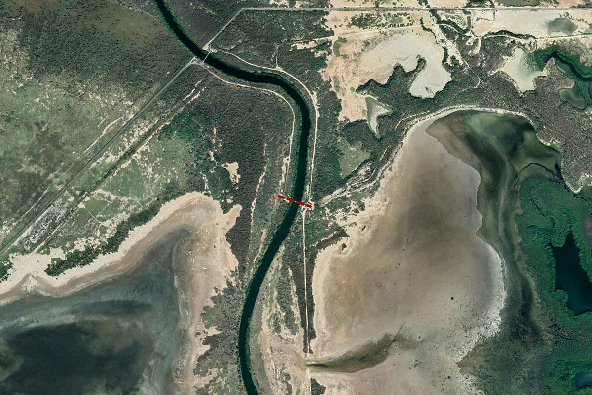
Guantanamo River Bridge
Map
Notes
The Guantanamo River Bridge is located approximately 4 miles up river.
Traveling beyond the bridge is prohibited -- warning signs are posted.
Manatees are often sighted in and around the Guantanamo River. The entire river is a no wake zone.
Coordinates
Guantanamo River Bridge: 19.963611 | -75.187630

